Colombia: Hike Los Nevados without a guide
Going hiking in Colombia’s famous Los Nevados national park? Great choice!
The goal of this post is to sum up all the info we collected before our hike, that helped us plan a great self-guided adventure for 5 days in March-April 2024. Here you will find some general info and different variations of the hike.
We know planning such trip can be overwhelming. It requires some patience, some Spanish and experience with hiking. Stay safe – best go in a group of at least 3, and if you don’t feel safe to do so, join a guided trip. Feel free to consult and share your recent knowledge in the comments.
About Los Nevados National Park
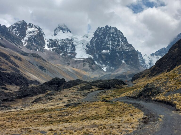
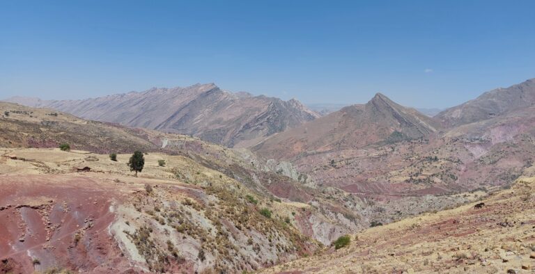
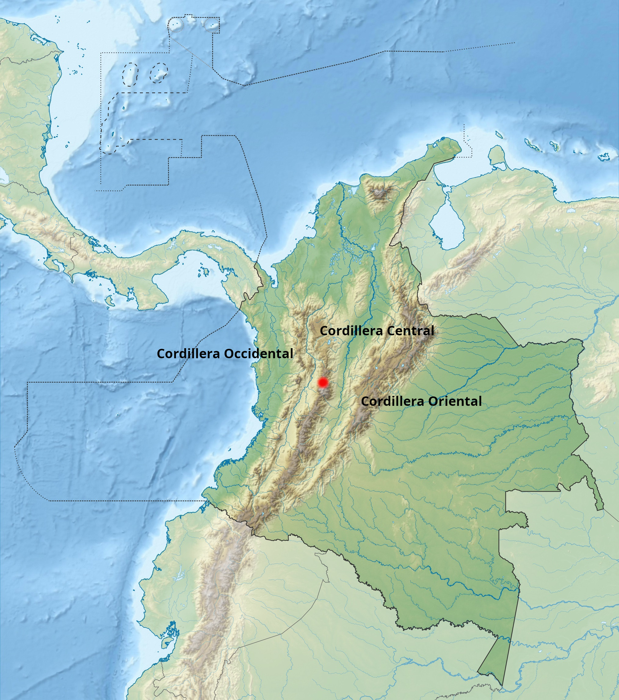
The area of PN (parque nacional) Los Nevados, just near the famous Coffee Axes, belongs to the Cordillera Central (central range), the highest of all Andean ranges passing through Colombia. The 583 square kilometer park is a volcanic area and contains the 3 highest volcanoes in Colombia: Nevado del Ruíz (5321m), Nevado de Santa Isabel (4965m) and Nevado del Tolima (5215m) among other elevated volcanic areas. “Los Nevados” stands for “the snowy” – because of the snow caped volcanoes in the park.
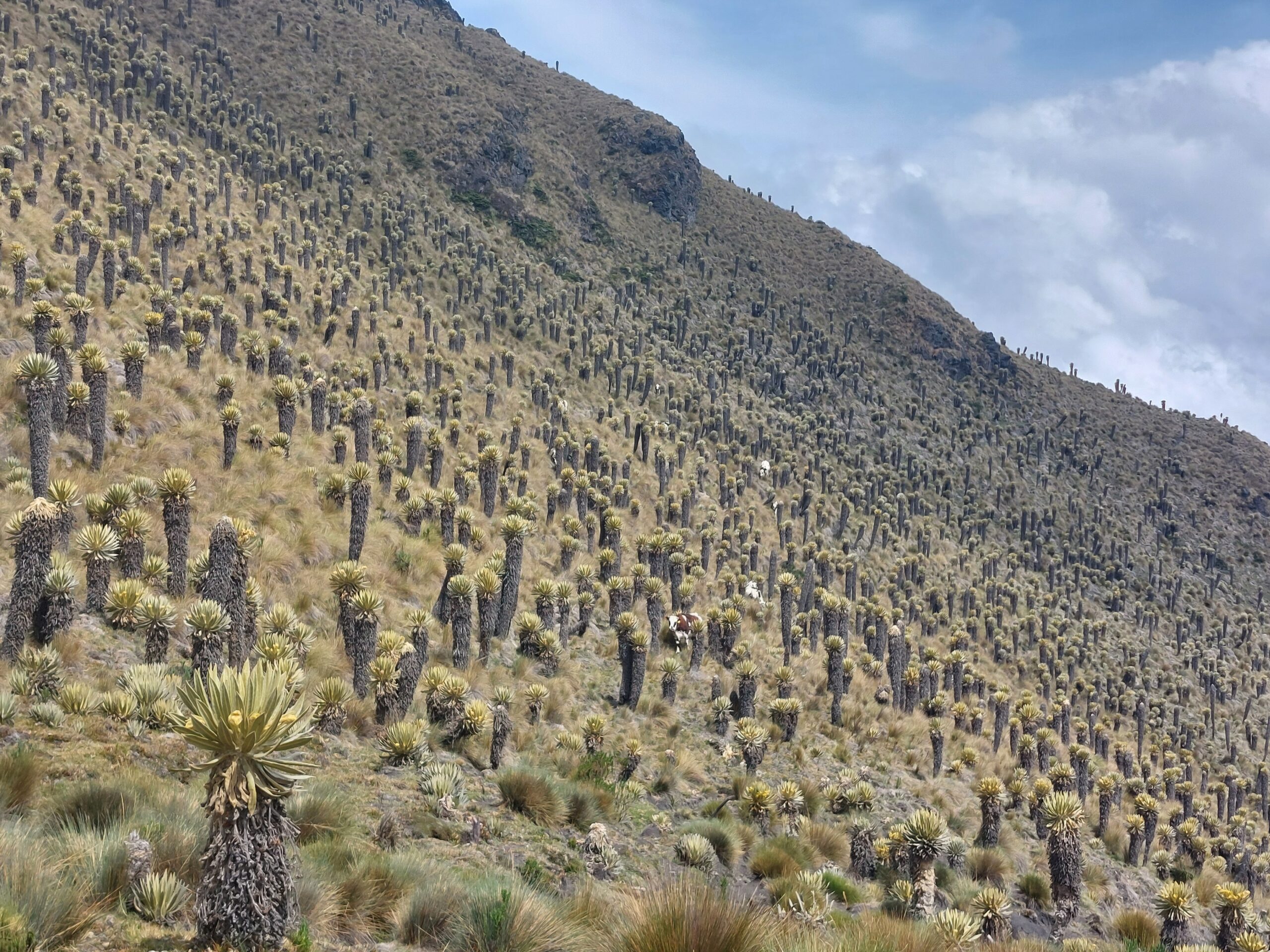
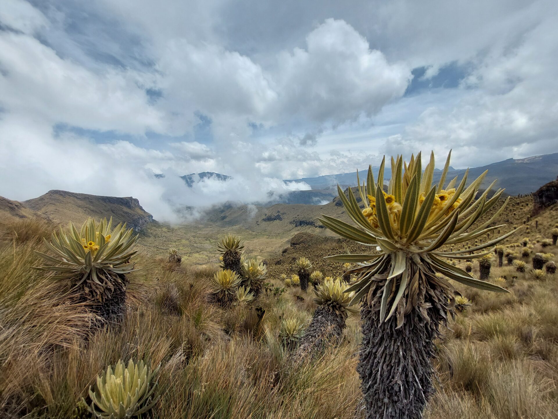
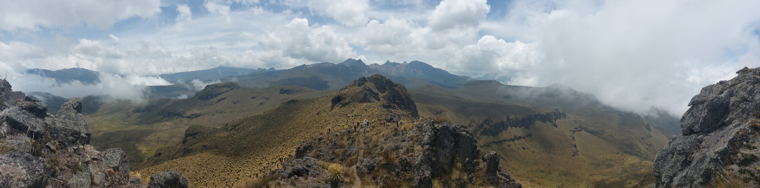
In addition to snowy volcanoes and glaciers, the national park contains an ecosystem unique to Colombia: the Páramo. You can observe the incredible Frailejon cactus, which in addition to being very cool, is also a vital part of Colombia’s water system. The water from the national park area are drinking water for over 2 million Colombians.
Best times to visit Los Nevados park in Colombia
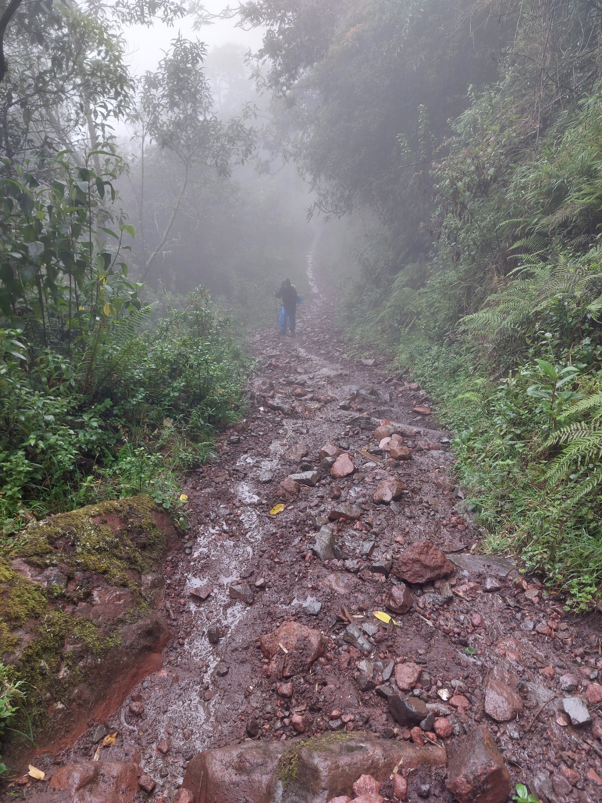
Dry season in Colombia is Dec-Jan. We did the hike at the end of March – already end of the season. At the first day we walked in rain and mud all the time, but were lucky the other days. However, as it’s high mountains, be prepared for every weather in every season (see packing list section).
Northern vs Southern Part of the Park
The volcano Nevado del Ruíz (5321m), located in the northern part of the Park, is considered active and therefore this area can only be hiked with a guided group. Hiking at this section has been established for years and the guides have a lot of experience.
Guided tours in the park
In general, entering the southern park does not require a guide (April 2024). However, climbing the volcanoes is not allowed without a guide.
There are advantages to a guided tour – it makes logistics much simpler (the company organizes everything) and you can also join a group if you are a single traveler. During our time in the mountains we met a group from Paramo track and were really impressed – the guides were really cool and professional, and their logistics worked like a clock.
Plan a Self-Guided Hike in Los Nevados
From here on, we will refer to self guided multi-day hikes in the southern part of the park.
Actually, there are multiple hikes possible in the area, that last from 2-5 or even 8 day variations. You can choose to do it with a tent, but camping is only allowed near the huts, and you are required to pay a fee to the owner.
Park entrances
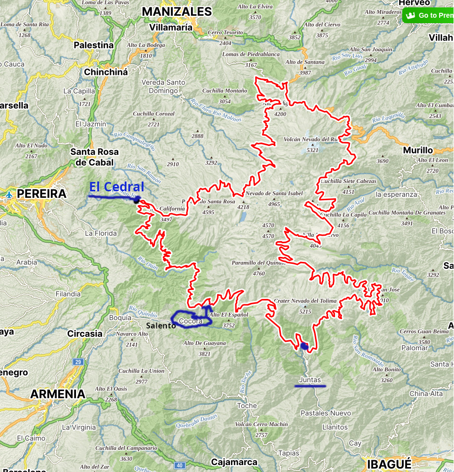
A full list of park entrances can be found in the official site of the park. As far as we understand there is no public transport arriving to the northern side, it’s only by car or sometimes just 4×4. If you go that way, you can organize a pickup with a tour company. Here are those relevant for the southern / western part:
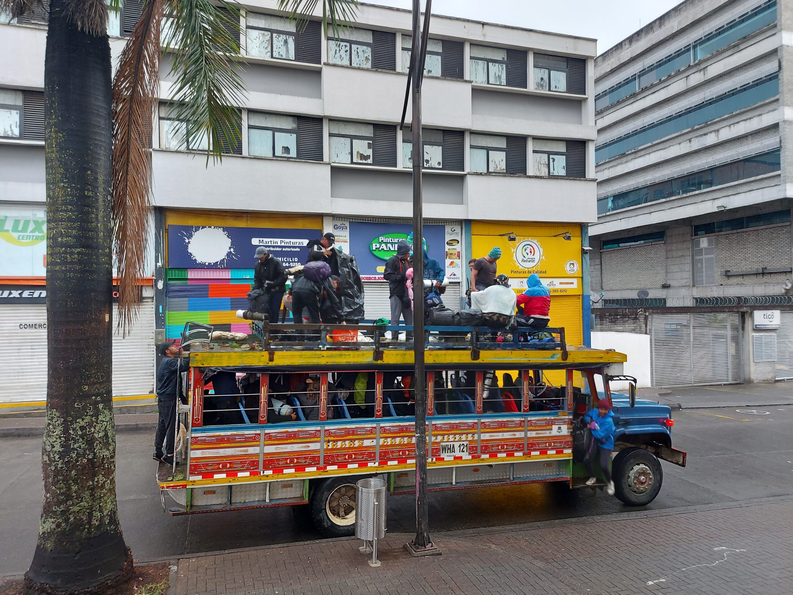
From Pereira: Take the Chiva to El Cedral entrance. The chiva is a cultural experience we really recommend, it’s super fun but can be packed on weekends and public holidays. The drive takes about 1 hour 15 minutes and is mostly in paved roads – but the last few KMs are quite bumpy.
Hours: During the week Chivas leave at 9:00 and 15:00 (April 2024). On weekends and holidays also at 7:00 and 12:00.
Location: The Chiva leaves from Plaza Victoria (south west of the square (between Carrera 10 and Carrera 12, across from the shopping center) and drives through La Florida.
Cost: 6600CLP (2024)
Return: The chiva normally parks in El Cedral for 1 hour and than returns to Pereira. Better confirm with your finca before heading there. There is a small shop at the end of the trail where you can buy drinks and snacks and celebrate that you made it 🙂
From Salento: Take a Willy from the main square going to Cocora valley. They go regularly during the day once they are full and take ~30 minutes to Valle de Cocora.
Cost: 4000CLP (2024)
From Ibague: we have no info, but seems to be an entrance in Juntas. Please let us know if you know and we’ll add it here.
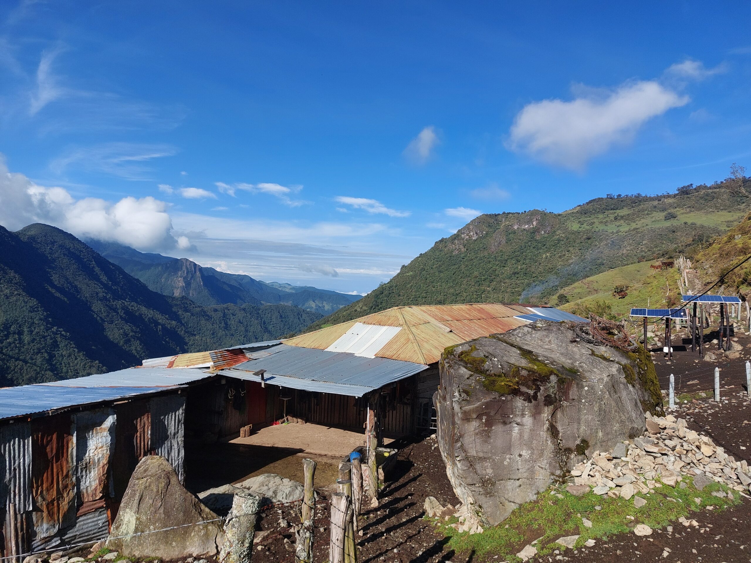
Fincas – Huts in Los Nevados National Park
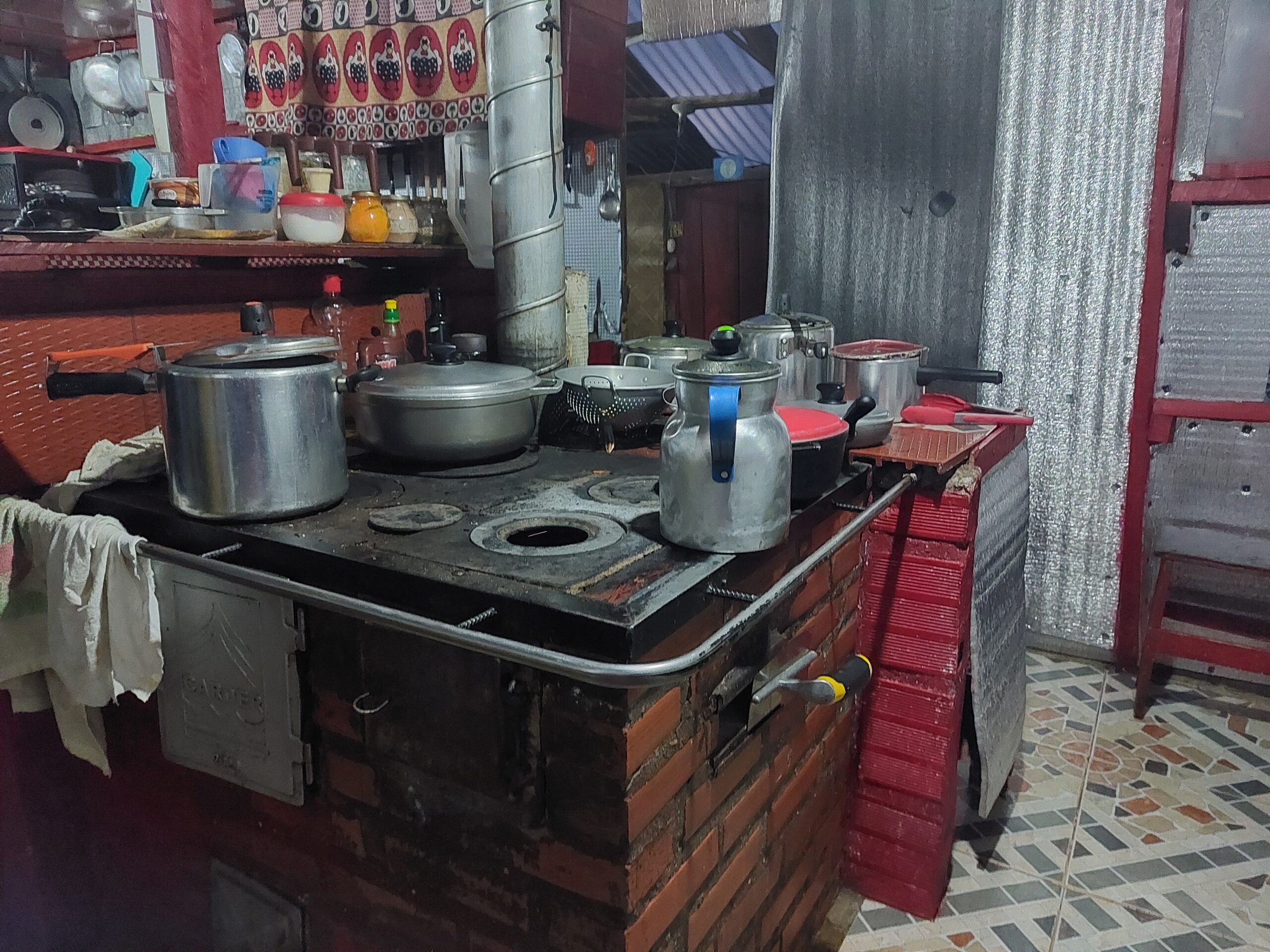
The huts are mostly active farms where one of the owners (mostly the women) is in charge of hosting and cooking for the guests, while the other is out with the cattle, sheep, horses, etc. You can expect meals including soup, rice and egg, both for dinner and breakfast, but sometimes there are nice fresh surprises. Some of the huts also sell some treats like candies and drinks (cash only). You get a bed as well as blankets (check with the hut beforehand), but bring your own liner. The huts are not well isolated and some of the rooms are kind of improvised from cardboard / foam so bare in mind it’s not warm. The electricity is sparse so phone charging is not an option – bring a power bank.
Most farms have quite international names so you can feel like you are hiking all over the world (e.g from Finca Berlin to Finca Argentina in just 1 day of hiking!)
This is a partial list of huts we collected and the phone numbers we have. You can call or write on whatsapp in Spanish (they have mostly starlink of some kind of wifi reception). We got some of the numbers by asking the hut owners for the next one. In square brackets you will find the altitude of the hut (in meters). In weekends and holidays it’s crucial to book in advance, and huts get fully booked by groups of Colombians.
- Finca El Bosque [3550m]
- Finca la Primavera [3600m] – we read they are not so friendly, and you can continue 20 minutes to the next finca (la playa) 3108327879 / 3122117677
- Finca la Playa [3730m] – 3115026741
- Finca la Argentina [3450m] – 3207251072
- Finca Buenos Aires [3800m] – 3155396109
- Finca Berlin [3806m] (Diego) – 3216294751
- Finca Africa [3790m] (most isolated in the park but should be beautiful)
- Porton de los Andes (we just saw a sign) – here and +12708894794
- Finca el Jordan [3340m] (Mariluz) – 3174464392
- Finca la Secreta (40 minutes up from El Jordan, there are a few houses belonging to the same family as finca Berlin).
- Finca la Pastora [2660m] (Gladis) – 3146426691
- Finca La Montaña [2900m]
List of Hike Variations we Found
- 3 days: Cocora –> Argentina –> Primavera –> Cocora (can add Finca Africa in the middle but it’s a big climb and adds +2 days) — description in Hebrew
- 5 days with a tent (can get muddy): El Cedral –> El Jordan –> Laguna Oton –> Africa –> Primavera –> Cocora — description in Hebrew
- 3 days: Cocora –> Argentina –> Berlin –> Manizales (met people that did this route with Paramo track)
- 3 days with a tent: El cedral –> el Jordan –> Laguna Oton –> el cedral (great description here)
- Our 3 versions detailed below:
our favorite day was between Finca Argentina and Finca Berlin, where the paramo is just incredible and there is an open view of the snowy peaks, which was what we were really missing in the ever-green Colombia landscape.
You can also use the guided tours websites to see more hiking variations in the park. If you did some other variation which you recommend, please share with us!
Our (original planned) version: 5 day hike from Pereira to Salento
We planned to hike it this way as we were already in the area of Pereira and were not sure we are in shape for the altitude. This version allows more acclimatization to altitude and an easy start at days 1-2.
Eventually, we heard the park is closed from this direction and had to change the path and do it the other way round and 1 day shorter, which ended up being great. But this was the original plan:
- Day 1: Pereira –> park entry at El Cedral, hike to La Pastora (7km, +460m)
- Day 2: La Pastora –> El Jordan (6.6km, +680m)
- Day 3: El Jordan –> Berlin (through laguna del Otun)
- Day 4: Berlin –> la Argentina
- Day 5: La Argentina –> park exit at Cocora, finish in Salento
Our (midway) version: 5 day hike from Salento to Salento
When we heard the entire western section was closed, we planned the following round:
- Day 1: Salento –> Park entrance at Cocora –> Finca la Argentina
- Day 2: Finca la Argentina –> Finca Berlin
- Day 3: Finca Berlin day trips
- Day 4: Finca Berlin –> Finca la Primavera / La Playa
- Day 5: Finca la Playa –> Salento
When we found out the section was re-opened, we changed plans again 🙂
Our (final) version: 5 day hike from Salento to Pereira
We ended up doing the following:
- Day 1: Salento –> Park entrance at Cocora –> Finca la Argentina
- Day 2: Finca la Argentina –> Finca Berlin
- Day 3: Stayed in Finca Berlin, day trip with a small backpack to Chispass
- Day 4: Finca Berlin –> La Secreta (original plan was El Jordan but they sent us away although we made a booking because they got a big group last minute). La secreta is more remote and authentic and usually has room, but it’s 40 minutes uphill that you’ll need to go back down the next day.
- Day 5: La Secreta –> park exit in El Cedral (-1300m) –> Pereira
Chispass
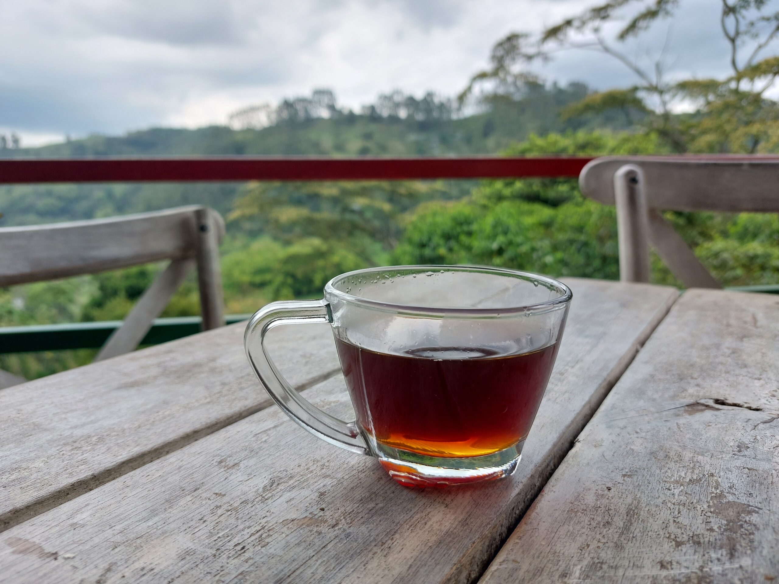
Half way between finca Argentina and Finca Berlin there is 360° observatory called Chispass. If the sky is not cloudy, we really recommend it as you can see Nevado del Tolima, Paramillo del Quindío etc. We spent there about 3 hours…
Other Logistics
Safety and Packing for the hike
- Water filter – due to the animals in the park, even the local families in the Fincas boil their water (mostly with Panela sugar 😉 ). We used our SteriPEN that was still alive at that point (later on we moved on to using Sawyer Squeeze).
- Liner – we had blankets in the huts and didn’t need to carry a sleeping bag. We recommend making sure it’s still the case before you go.
- Food (snacks) – you can get in the huts dinner and breakfast and also coordinate with them to get snacks for lunch. Our lunch was nuts, oats, energy bars and chocolate. We brought our camping stove and made coffee whenever needed 🙂
- Power bank – there was no option to charge the phones in the huts. We had 2 phones and 2 power banks and used them for navigation and taking pictures.
- Rain gear – in Colombia when in rains, it pours! Make sure you have a poncho / rain jacket and pants, a cover for your backpack and at best, some nylon bags to keep everything dry.
- Gear for cold weather – during the night in the altitude, temperatures can get around 0 degrees Celsius. Leggings, warm socks, gloves, scarf, beanie etc are all highly recommended.
- Sun protection – after you get to the paramo, the path is entirely exposed to the sun.
Please note this hike goes through high altitudes. Plan enough time to acclimate before you start and don’t rush. If you feed any symptoms of altitude sickness, going down is the best solution.
Where to Buy Supply Before the Hike
Pereira: A real city (480k people!) with shopping centers. There are sports / hiking stores, electronic stores, supermarkets with specialty products (e.g gluten-free), a market and more. We got gas for our cooking stove too, but we forgot where (maybe in Exito?) — please let us know if you are there and find these items!
For getting coca leaves (for altitude), the lead we got was Tienda Agroecológica Cogollo, but they didn’t have any at the time we were there.
Salento: A small village. You can get basic supply in the small supermarkets and stores (oats, mashed potatoes etc) but it’s quite limited. There are a few local companies where you can rent hiking gear (but we heard the prices are quite high). At least you can get great coffee at Finca El Ocaso before or after the hike. We were able to get a rain set (jacket + pants) for Shir at the only gas station in town.
In the southern side of the park, Ibagué is the option to get supply, but we haven’t been there – it’s a city with over 500k inhabitants.
Additional Sources of Information
In addition to the blogs we already described in the hike option section,
High quality map with the main points of interest in the park
Official website of the park – lots of information in spanish
Using this facebook group (in Spanish), this blog (in Spanish, including maps), good info about logistics in this blog. Good safety rules of thumb here.
Our best way of planning the route was using mapy where we looked at the huts and the distances between them.
More about the park
The issue of Farming
Los Nevados was only declared a national park in 1973. Before that, few families of farmers have lived in the mountains and made their living mainly from cattle herding. The authorities try to encourage them to switch from farming to tourism (for example by turning their fincas to huts for hikers), but unfortunately they have no real manners to enforce the change. The farmers can’t rely only on tourism due to the closures of the park, and you can see cows wandering around the area and eating freilejon :/